
Maluti a Phofung
The municipality is bordered by Phumelela in the north, the Kingdom of Lesotho in the south, the KwaZulu-Natal Province in the east, and Dihlabeng in the west.
Composition of Council
70 seats · 36 to governNo party won a majority. The ANC is the largest party with 21 of the 70 seats, short of the 36 needed to govern alone, so the council needs a coalition or a minority government.
2026 election result
179,217 valid votes · Source: Electoral Commission (IEC)| Party | Share of vote | Ward seats | PR seats | Total seats |
|---|---|---|---|---|
| African National Congress (ANC) | 29.6% | 20 | 1 | 21 |
| African Content Movement (ACM) | 21.0% | 7 | 8 | 15 |
| Democratic Alliance (DA) | 18.9% | 4 | 10 | 14 |
| Mapsixteen Civic Movement (MCM) | 7.6% | 3 | 3 | 6 |
| Economic Freedom Fighters (EFF) | 4.7% | 0 | 3 | 3 |
| South African Communist Party (SACP) | 2.1% | 1 | 1 | 2 |
| African Transformation Movement (ATM) | 2.1% | 0 | 2 | 2 |
| Dikwankwetla Party of South Africa | 1.6% | 0 | 1 | 1 |
| Freedom Front Plus (FF+) | 1.4% | 0 | 1 | 1 |
| African Congress for Transformation (ACT) | 1.0% | 0 | 1 | 1 |
| Community First Alliance (CFA) | 1.0% | 0 | 1 | 1 |
| Baahi Civic Movement (BCMT) | 0.9% | 0 | 1 | 1 |
| African People's Movement (APEMO) | 0.8% | 0 | 1 | 1 |
| Patriotic Alliance (PA) | 0.6% | 0 | 1 | 1 |
Parties that won seats. Shares of the vote are from the proportional representation ballot.
Composition of Council
69 seats · 35 to governThe council has 70 seats with 10 political parties represented in council. The ANC is a leading party with 28 seats but falls short of the requisite 36 to govern alone. The current coalition is made up of ANC and EFF totalling 35 seats.
Historical Timeline
The council was constituted on November 2021 with three changes. Hover a bar for details.About
The municipality is bordered by Phumelela in the north, the Kingdom of Lesotho in the south, the KwaZulu-Natal Province in the east, and Dihlabeng in the west. It is one of the six municipalities that make up the district. Maluti-A-Phofung Municipality was established on 5 December 2000 in terms of the Provincial Gazette No. 14 of 28 February 2000, issued in terms of Section 21 of the Local Government Notice and Municipal Demarcation Act 27 of 1998.
News
See all › Twenty-three by-elections take place around the country
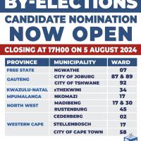 The Electoral Commission publishes by-elections and candidate nominations across South Africa